
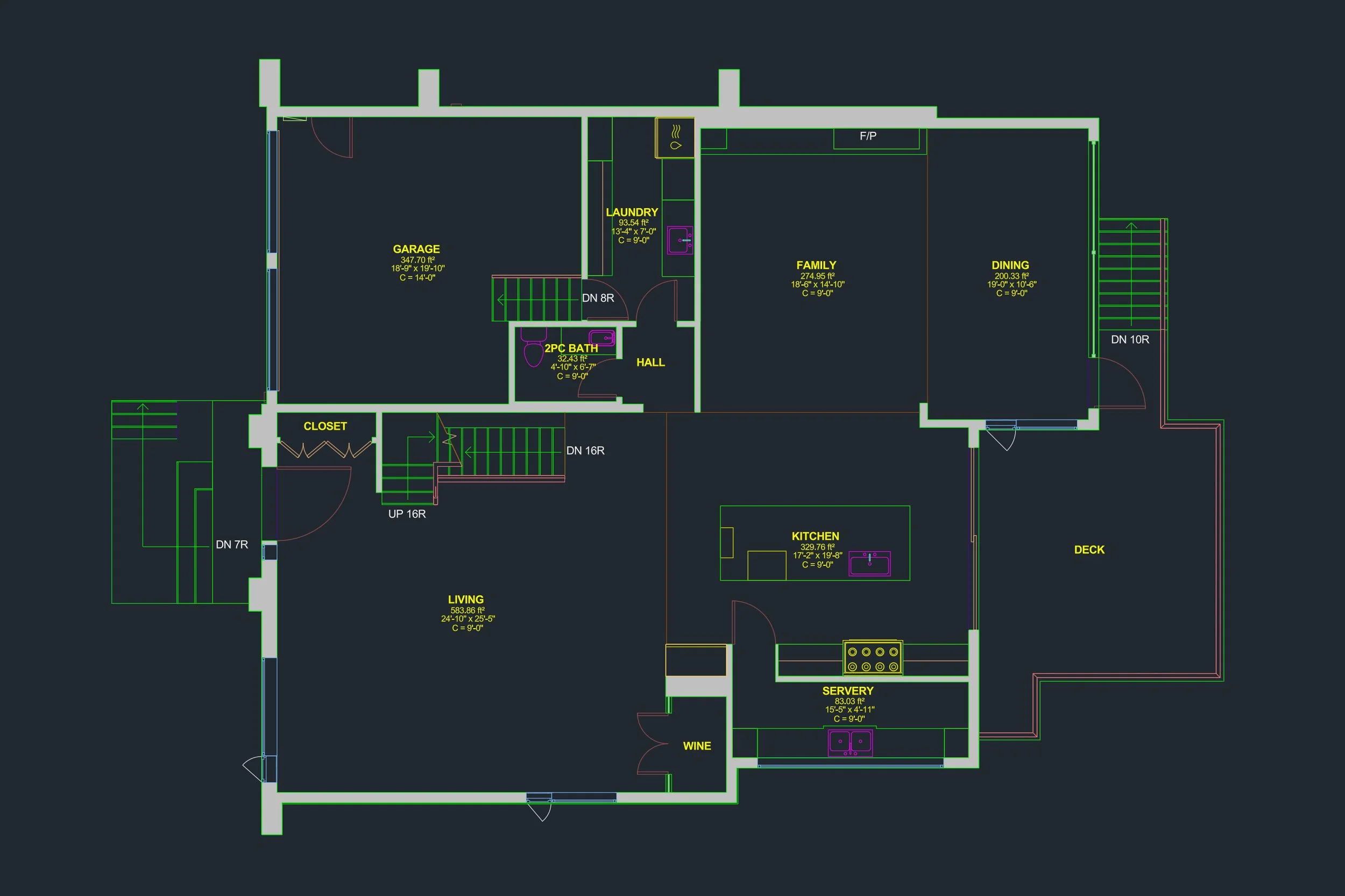
3D LiDAR Site Scanning
&
Digital Property Measurement
Every successful construction project begins with accurate information.
Arthur James Construction uses professional 3D LiDAR scanning technology to create highly accurate digital models of homes and properties. Whether you're planning a renovation, detached garage, addition, excavation, or landscape project, our scanning process provides the precise measurements needed for smarter planning and better construction.
Build
With Confidence
Traditional measuring
methods can leave room for error. Our advanced 3D scanning technology captures millions of measurement points to create an accurate digital representation of your home or property.
This allows us to design, estimate, and build with confidence while reducing costly surprises during construction.
WSIB compliant
Local to Collingwood
Fully insured
Why We Use LiDAR
Instead of guessing...
We measure.
Instead of relying on hand sketches...
We create a complete digital model.
Instead of discovering problems during construction...
We identify them before work begins.
By combining advanced scanning technology with years of construction experience, we can plan projects more accurately, improve communication, and reduce delays throughout the construction process.
-
Property Visit
We visit your property and perform a complete 3D LiDAR scan.
-
Digital Capture
Millions of measurement points are collected to accurately document your home and property.
-
Interactive Digital Model
Your property is transformed into an interactive digital model that can be reviewed long after the site visit.
-
Planning & Design
The scan becomes the foundation for estimates, permit drawings, design work, and construction planning.
-
Construction Begins
Your project moves forward with confidence using precise existing-condition information.
Why Choose Arthur James Construction?
We're not just operating a scanner.
We're experienced builders.
That means we know what measurements matter before excavation begins, where additions commonly create challenges, how grading impacts drainage, and what information architects, engineers, and building officials need to move projects forward.
Technology is only valuable when it's backed by construction experience.
Benefits
Why Start With a 3D Site Scan?
Accurate Measurements
Capture existing conditions with exceptional accuracy.
Better Planning
Design projects around real-world conditions rather than assumptions.
Faster Estimating
Accurate measurements lead to more reliable pricing and fewer unexpected costs.
Reduced Construction Errors
Identify challenges before construction begins.
Improved Permit Drawings
Provide a highly accurate foundation for permit and design documentation.
Better Client Experience
Visualize your project before construction begins.
Let’s build
something together.
Service area
Serving Collingwood, The Blue Mountains, Wasaga Beach, Stayner, and Creemore. If you are nearby, send your address and we will confirm availability.